Scientific Goals:
A common Geoscience paradigm holds that the Earth surface is shaped mainly by climate (eroding soil) and tectonics (building mountains). The EarthShape project challenges this paradigm to explore how in addition biologic processes form soil, influence topography, and thereby shape the Earth surface and modulates the impact of climate change on the Earth surface.
The influence of microorganisms, plants, and animals on the formation of soils and the shape of topography is still poorly understood, but new scientific technology now allows to identify their role. Research into biologic controls on topography is particularly important for understanding how future climate and biologic changes will impact the Earth’s surface.
In 2019 we have created a movie summarizing our goals. You can find the playlist of the English, Spanish and German versions on Youtube.
![]()
The four reasearch clusters of the Earth Shape project.
EarthShape research is conducted in the Chilean Coastal Range that features one of Earth’s most spectacular vegetation gradients and is controlled by climate ranging from arid to humid temperate. It is a natural laboratory to study how biology and topography interact. This latitudinal gradient allows for a “space for time approach” aiming at understanding how the climate change predicted globally can induce biota changes that in turn drive landscape formation. The field area focuses on the non-Andean part of Chile, and avoids the complexities of formerly glaciated landscapes.
EarthShape shall bring together an consortium of different scientific disciplines in the Geosciences, Ecology, Soil Sciences, Hydrology, Microbiology, and Geography to work on a common problem of human relevance. The new and innovative aspect of this Priority Program is the integration of different Bio- and Geoscience communities that work on different time scales. Emphasis is placed on non-anthropogenic geomorphic processes. The project has a strong collaboration with leading Chilean scientists from several disciplines.
The Deutsche Forschungsgemeinschaft awards priority programs like this to provide a community -driven mechanism for research on the cutting edge of Science. The program aims to fund large research programs with multiple institutions with an emphasis on collaborative science between disciplines. Participation in the project is subject to submission of individual projects at the Deutsche Forschungsgemeinschaft.
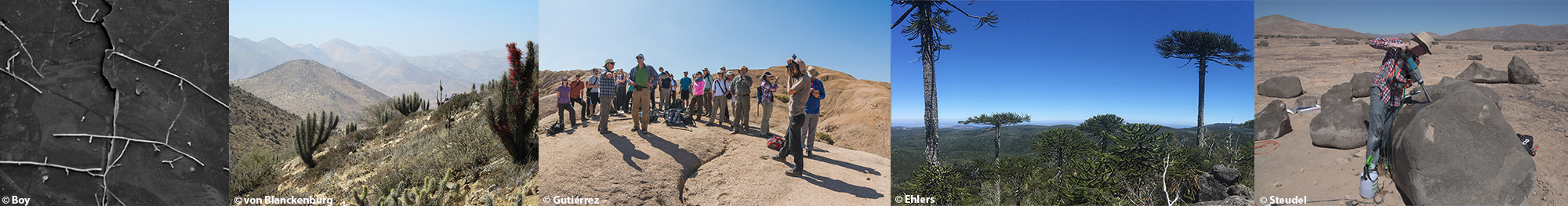
The initiative is coordinated by Prof. Todd Ehlers from the Department of Geoscience at the University of Tübingen and Prof. Friedhelm von Blanckenburg from the Helmholtz Centre Potsdam GFZ German Research Centre for Geosciences. The program allocates €10.2m over two periods of three years each for the project titled: "EarthShape: Earth Surface Shaping by Biota".
The scientific goals of the EarthShape program are to investigate four linked processes and one modeling cluster. Individual projects within the EarthShape project are encouraged to investigate one or more these components in the Chilean field sites. Details of each component of the project are given below.
Cluster 1: Micro-biota as the “weathering engine”
In cluster 1 we investigate how weathering interactions of rocks and minerals with biota (plants and microorganisms) produce ubiquitous soil cover. Over the time scale that a column of soil is overturned by erosion (~104 years) geomorphologists and geochemists have observed that rates of chemical weathering are correlated with those of erosion. A feedback is hypothesized to exist between these two processes such that it ensures that the production of soil by weathering keeps pace with erosion, eventually resulting in a large part of the terrestrial land surface being covered with soil. However, while a number of observations (from river fluxes, chemical mass balances, and cosmogenic nuclides) demand that such a feedback exists, its actual mechanism remains elusive. Biologists, ecologists, and geochemists recently provided evidence that the above-mentioned feedback is engineered by biotic action, thus overcoming the traditional geological view that considers weathering as a predominantly abiotic process. Those studies laid the ground for a paradigm change, though detailed processes are largely unexplored as the biotic weathering rates are unquantified in situ at the ecosystem scale. Investigations in this cluster involve quantifying different mechanisms of biogenic weathering. Our approach is to quantify the biological organism network whereby plants, fungi, and bacteria interact in the production of soils. |
Interactions between geologic, biologic, and hydrologic processes involved in the production of weathered material. |

Cluster 2: Bio-mediated redistribution of material within the weathering zone
Cluster 2 focuses on quantifying how surface processes and biota interact vertically and horizontally within a soil column. There are several ways plants indirectly affect the vertical redistribution of dissolved elements in the weathering zone: plant water uptake and subsequent loss via transpiration significantly alters the soil-moisture content of the upper soil layer and engineer a change in the downward and lateral transport of solutes and nutrients; soil respiration leads to a decrease in soil O2 concentration and thus a decrease in the redox potential of the soil, thereby increasing the solubility of iron and complementing weathering reactions ; terrestrial plants take up nutrients, but also non-nutritive elements like heavy metals or radioactive compounds, and these elements are incorporated into plant tissue according to biological stoichiometry and are returned to near-surface soil layers via litter production. Quantifying the rates and magnitudes of these processes within a soil column and across a hillslope motivates investigations into this process. |
Conceptual diagram of the redistribution of material within the weathering zone. |

Equally important, plants affect the structure of soils and the transport of solid material within the weathering zone. Plants can contribute to horizontal translocation of soil material. For example, wind-thrown trees in sloped terrain lead to the formation of mounds originating from the decomposing root plate. Soil fauna also play a role in horizontal and vertical transport of solid materials within the weathering zone.
Investigations in this cluster will study soil catenas along hillslope profiles to investigate the movement of dissolved, mineral, and organic materials along the transport trajectory in different Chilean vegetation zones.
Cluster 3: Biotic modulation of erosion and sediment routing at the catchment-scale. |
This cluster addresses the biotic influence on erosion and the transport of solid and dissolved material. Previous work suggests that if vegetation cover decreases below a certain level then hillslopes lose their regolith cover. Consequently, diffusive transport processes that characterize soil-mantled landscapes, such as rain splash, soil heave, and bioturbation, would give way to advective processes such as erosion due to overland flow. The increase in sediment fluxes, the associated loss of soil resources due to particulate-bound nutrients and alterations in soil texture may in turn affect the vegetation cover. As a result vegetation and resource patterns emerge as an optimized response to local-scale interaction in the landscape. This relationship between vegetation and erosion is further complicated by climate variability. Particularly, little is known of how vegetation dynamics modulate erosional efficacy over various time scales such as from wild fires to glacial-interglacial cycle changes in precipitation and temperature. |
Schematic of the catchment scale transport of material in different biomes. |
| Likewise, systematic studies of how landslides, debris flows, and other colluvial processes interact with biota, are highly desirable, particularly when it comes to quantifying the maximum mitigation efficacy of vegetation cover against deep-seated landslides or related geohazards. Work in this cluster will use the entire ecological gradient in the Chilean coastal range to explore the effects of vegetation cover and type on solute and sediment transport from hillslopes to the channel network. | |

Cluster 4: Depositional legacy of coupled biogenic and Earth surface systems
This cluster describes how changes in sediment accumulation pattern on the land-scape scale enable the development of new vegetation types, and how biota in turn stabilizes these accumulation zones leading to new geomorphic features. Dynamic interaction between vegetation and sedimentation are documented for a number of depositional environments and biomes. A growing body of literature shows that specific vegetation characteristics (composition, density) modify geomorphic processes in depositional environments. For example, during the Quaternary, climate-driven shifts in vegetation patterns caused major changes in the quantity and type of sediment supplied to channels. Thus changing vegetation cover may not only modulate hillslope sediment supply, but also influence floodplain deposition, nutrient availability and lateral channel stability through altered bank stability. |
Conceptual diagram of biogenic interactions with depositional processes and sedimentary archives of EARTHSHAPE processes. |
Changing vegetation also creates different pathways for the redistribution of nutrients. Several studies indicate that ecological changes can lead to catastrophic changes in fluvial processes. Knowledge on the complex feedbacks between vegetation and depositional landforms can support decisions concerning the conservation and restoration of depositional environments and related ecosystems. Work in this cluster will focus on studying depositional environments where a well-defined upstream catchment or sediment source is available. The short-term (annual to decadal) and long-term (millenial to glacial/interglacial) relationship between depositional processes and vegetation composition will be explored using proxy data from sedimentary (terrestrial and coastal) archives. | |

Bridging time scales with coupled system modeling EarthShape intends to integrate the four research clusters and bridges between time scales through numerical modeling. This could include modeling expertise in: landscape evolution, soil erosion, surface and near surface hydrology, dynamic vegetation, eco-hydrological, and geochemistry. These models will be calibrated with present-day climate data, and inventories of vegetation and sediment fluxes, and then extrapolated to longer time scale data sets such as from lakes and floodplains. |